
949.777.2000
Employee Portal
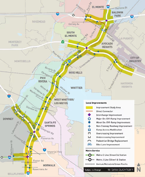
As a subconsultant to the design engineering consultants, GUIDA is providing survey, mapping, and right of way engineering for projects along the I-605 corridor in Los Angeles County. The individual projects merged into the I-605 CIP include:
For various locations within the I-605 CIP, GUIDA provided project control surveys tied to the Caltrans District 7 primary controls, aerial photogrammetric mapping in accordance with the Caltrans A-B-C standards, and initial land net surveys including preliminary property boundary assessments, determination of the existing right of way, and the underlying cadaster affected by the proposed project improvements. All surveying services were performed and delivered to the design engineering team in accordance with the Caltrans survey manual.
Control Survey
Design Survey
Aerial Mapping & Airborne LiDAR
Land Net Survey & Mapping
Legal Descriptions
Appraisal Maps
Right of Way Engineering
We're Here to Help
Have a question or need guidance?
Our team is ready to help.
Or connect with us directly at one of our offices below.
380 State Place
Escondido, CA 92029
4695 Chabot Dr, Suite 115
Pleasanton, CA 94588
3237 E Guasti Rd, Suite 260
Ontario, CA, 91761
220 Commerce, Suite 150
Irvine, CA 92602
550 W. Alluvial Ave, Suite 109
Fresno, CA 93711
900 E. Hamilton Ave, Suite 100
Campbell, CA 95008
949.777.2000