
949.777.2000
Employee Portal
Topographic design surveys are performed for a variety of project types from planning and engineering design, to identifying encroachments and post construction as-built surveys.
GUIDA understands the importance of proper communication and collaboration with the project team to understand what is required and expected for the project. With all design surveys, too little or too much data can be collected. Understanding what needs to be surveyed is just as important as performing the survey.
GUIDA utilizes a variety of methods, or a combination of them, to develop the design surveys required for any project. Design survey data can be developed from conventional survey methods, such as total stations, GPS/GNSS methods, and by terrestrial and mobile LiDAR methods.
GUIDA will directly produce deliverables in either platform to support our clients’ projects. All topographic survey deliverables can be done in various versions of AutoCAD Civil3D and MicroStation and InRoads; or it can be done in both.
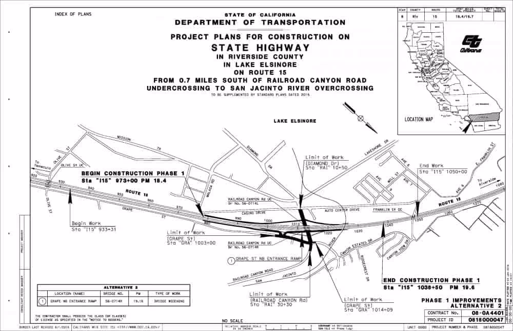
GUIDA provided design surveying services to support the development of plans, specifications, and estimates (PS&E) for the I-5 Managed Lanes project, including horizontal and vertical control surveys, topographic design surveys of bridges, mainline pavement surveys, along with right of way surveys and engineering.
GUIDA provided horizontal and vertical controls, topographic design surveys, utility pothole, geotechnical borehole survey support, and other mapping in support of the I-405 Improvement Project. Guida has been responsible for establishing and augmenting project controls and the design surveys for more than 40 miles of highway and local streets.
For more than 20 years, GUIDA has provided on-call land surveying and mapping services for numerous improvement projects including infrastructure pipelines, sewer and water pipelines, reservoirs, and other facility improvements.
We're Here to Help
Have a question or need guidance?
Our team is ready to help.
Or connect with us directly at one of our offices below.
380 State Place
Escondido, CA 92029
4695 Chabot Dr, Suite 115
Pleasanton, CA 94588
3237 E Guasti Rd, Suite 260
Ontario, CA, 91761
220 Commerce, Suite 150
Irvine, CA 92602
550 W. Alluvial Ave, Suite 109
Fresno, CA 93711
900 E. Hamilton Ave, Suite 100
Campbell, CA 95008
949.777.2000