
949.777.2000
Employee Portal
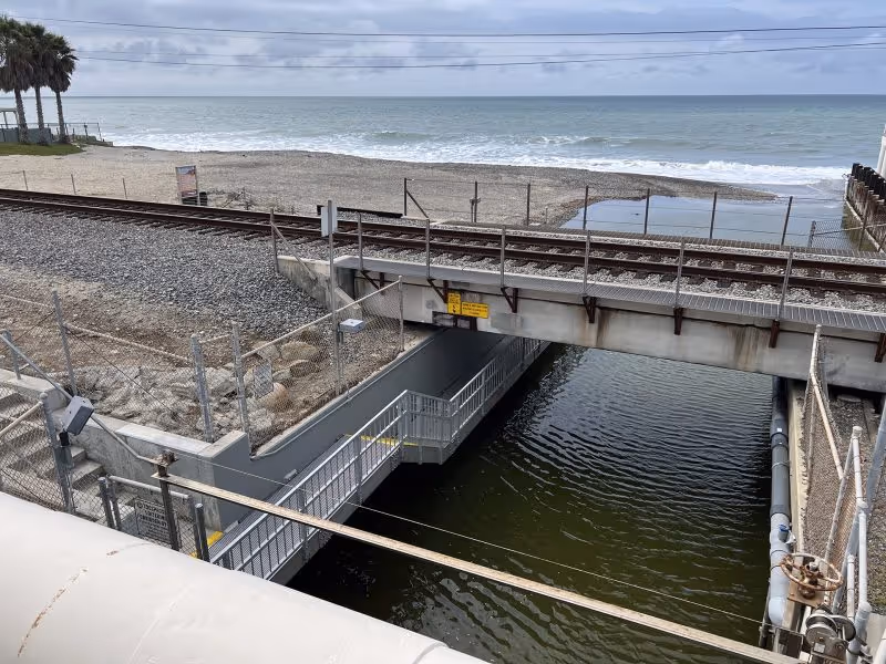
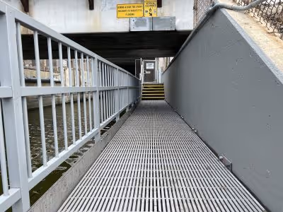
The Poche Beach Walkway in Dana Point, CA is a pedestrian access route from Coast Hwy to Poche Beach, crossing under the train tracks. The catwalk was subjected to harsh marine conditions and needed replacement due to corrosion and deterioration. OC Parks contracted Biggs Cardosa to design the replacement structure with support from GUIDA. As a subconsultant, GUIDA performed LiDAR surveys, field data collection, and field to office calculations for the Poche Beach Walking Tunnel. Laser scanning was used to create a Scan Data Point cloud for the project in lieu of more traditional survey methods. The walkway replacement consisted of stainless steel and fiberglass-reinforced polymer materials, which will withstand the harsh marine conditions.
This major repair project received the ASCE OC 2022 Outstanding Structural Engineering Project Award for restoring safe access to one of South Orange County’s unique beaches!
Laser Scanning Surveys
LiDAR Surveys
Field Data Collection
Field to Office Calculations

We're Here to Help
Have a question or need guidance?
Our team is ready to help.
Or connect with us directly at one of our offices below.
380 State Place
Escondido, CA 92029
4695 Chabot Dr, Suite 115
Pleasanton, CA 94588
3237 E Guasti Rd, Suite 260
Ontario, CA, 91761
220 Commerce, Suite 150
Irvine, CA 92602
550 W. Alluvial Ave, Suite 109
Fresno, CA 93711
900 E. Hamilton Ave, Suite 100
Campbell, CA 95008
949.777.2000